-
AI
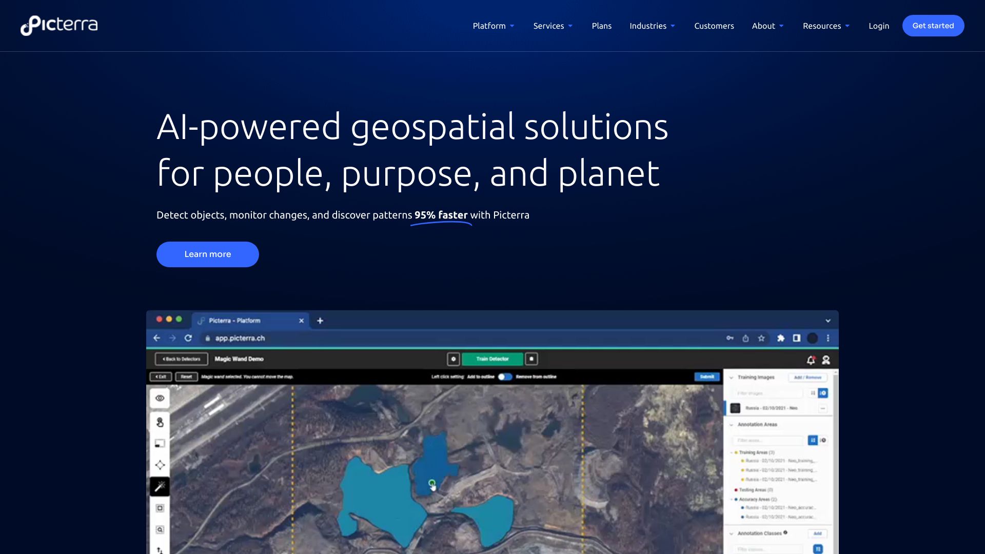
Picterra is a software platform for the training, deployment, and management of machine learning models powering geospatial apps and business services. It provides AI-powered geospatial solutions for detecting objects, monitoring changes, and discovering patterns in satellite, drone, and aerial imagery 95% faster.23 Nov 2023Readmore -
Data annotation
Pixta AI is a large-scale data annotation and data sourcing service for AI. They provide fully-managed annotation services and off-the-shelf datasets to accelerate AI development. With a team of 1000 experienced annotators and access to over 75 million images and 5 million videos, Pixta AI offers high-quality solutions for various industries.22 May 2023Readmore -
Image annotation
DataVLab offers high-quality image annotation and data labeling services for AI and machine learning models. They provide comprehensive AI-powered solutions including image annotation, video annotation, 3D annotation, custom AI projects, NLP & text annotation, and GenAI & LLM solutions. DataVLab serves diverse industries such as energy, autonomous vehicles, satellite & aerial, insurance, fashion & luxury, retail & e-commerce, agriculture & environment, and healthcare.17 Feb 2025Readmore -
Satellite data
EOS Data Analytics (EOSDA) is a global provider of AI-powered satellite imagery analytics founded by Dr. Max Polyakov. EOSDA provides access to extensive satellite data and advanced analytical tools developed by their expert team to support the decision-making process. They specialize in generating sustainable satellite-driven AI-powered solutions in agriculture and forestry, with the ability to extend solutions to other niches upon request.27 Jul 2024Readmore